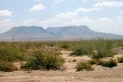
Brukkaros Crater
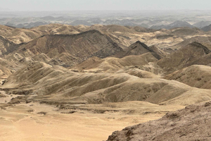
The Brukkaros Mountain reaches about 1,590m high just south of the town of Mariental. Thought to be the result of an underground gas explosion, the hollow was created when the walls of a cavity caved in. The second theory is that it is an extinct volcano due to its shape. The name refers to a piece of clothing worn by local Nama women. Bruk refers to the Afrikaans word "broek" meaning trousers and karos, a leather apron. Fascinating hiking trails lead up the mountain but be sure to take enough water as the trails can extend to 2 hours each. One of the trails leads to the abandoned research centre. From 1926 to 1931, the Smithsonian Institute and the National Geographic Society conducted daily solar radiation readings here. The mountain also boasts a camping site with basic facilities, an incredible opportunity to view the extensive night skies.